• Profile
    • Approach
    • People
    • Publications
  • Projects
  • Competitions
  • News
  • Blog
  • CONTACT
Menu

Corkery Consulting

Landscape Architecture + Urban Design | AUSTRALIA
  • STUDIO
    • Profile
    • Approach
    • People
    • Publications
  • Projects
  • Competitions
  • News
  • Blog
  • CONTACT

Hunters Point Park, New York

June 17, 2017

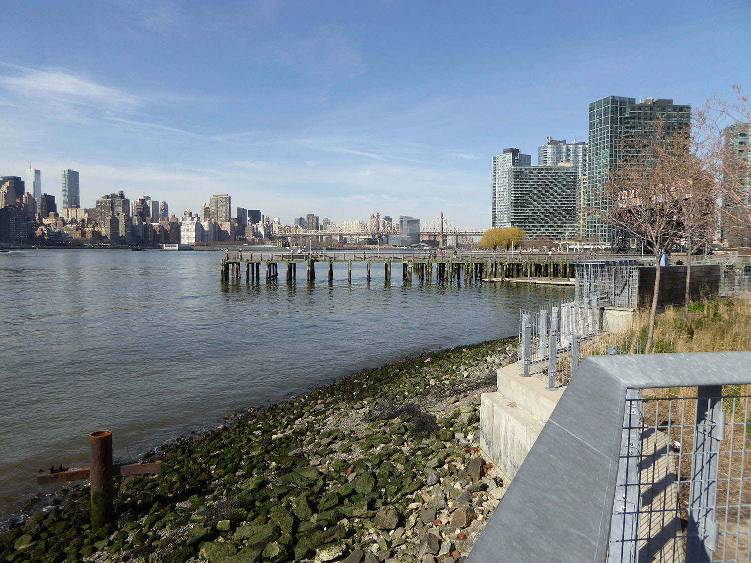
The post-industrial waterfronts of New York City continue to undergo a dramatic transformation that is resulting in the creation of extensive new public open spaces. Located in Long Island City Queens, Hunters Point Park is another example of this transformation of abandoned post-industrial waterfront land to public open space use. The Park forms a key component of Phase 1 of the Hunter’s Point South Project which involves the creation of a new mixed-use neighbourhood incorporating affordable housing, retail, open space and a new public school on 12 ha of prime waterfront property. Completion of Phase 2, which is currently under construction on adjoining land, will include additional residential development and completion of Hunters Point Park.

Context Hunter’s Point South Project Plan
Source: New York City Economic Development Corporation

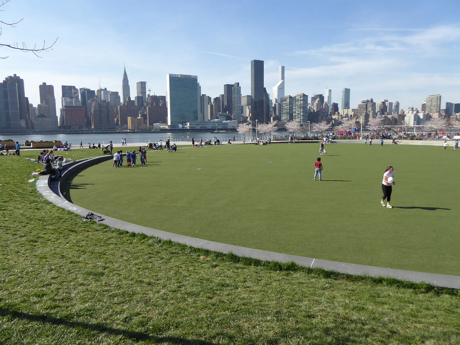
Located on the waterfront of the Hunter’s Point South Project the 2.2 ha Park functions as a public open space for locals and other Long Island City residents as well as visitors to New York City. The Park provides a diverse combination of integrated recreation facilities and opportunities for social interaction that include a central green, large playground, dog run, bikeway, waterside promenade, basketball court, sandy ‘beach’, adult fitness area and a garden incorporating historic rail tracks that reflect former site uses. A 1,200 square metre pavilion designed by Weiss/Manfredi architects features a dramatic roof and incorporates an elevated cafe plaza and seating terraces with views across the East River to the Manhattan skyline.

Hunter’s Point South Project Plan
Source: New York City Economic Development Corporation

Construction of the Park project was led by the New York City Economic Development Corporation and New York City Parks operate and maintain the Park. The landscape architecture firm of Thomas Balsley Associates worked in collaboration with Weiss/Manfredi architects to design the park. Driven by a commitment to create a vibrant recreational environment for New Yorkers and visitors the designers incorporated sustainability principles that include:

  • alternative transportation options, such as the inclusion of a Class 1 bikeway

  • bio-filtration swales along the length of the park

  • planting of native species of grasses and trees

  • use of environmentally sustainable wood

  • remediation of formerly contaminated industrial land

  • solar orientation of the site and buildings to optimizes passive heating and cooling, and provides for solar energy generation

  • 64 photovoltaic panels located on the roof of the pavilion will generate 37,000 kWh per year, providing over 50 percent of the park’s power requirements.

Design of the pavilion allows for additional panels to be installed on the roof to provide 100 percent of the operating power of the Park. The pavilion also houses LEED Silver-certified public restrooms, maintenance and office space, and a future food concession.


In order to ensure that the Park is resilient to the impacts of climate change, the design involved for significant modifications to the shoreline, employing bulkheads and riprap to better withstand the possibility of future flooding from the East River. Outside of the Park, seven streets connecting to the area also function as extensions of the park landscape. Featuring bike paths and additional plantings the design of the streets in intended to encourage pedestrian traffic and create an inviting approach to the waterfront park. 

At a total cost of US$66 million the Hunter’s Point South Waterfront Park and related infrastructure was financed primarily by the City’s Department of Housing Preservation and Development, with the Federal Highways Administration providing US$1.56 million for roadway development.

View fullsize Central Green 1
Central Green 1
View fullsize Central Green 2
Central Green 2
View fullsize Cherry Blossom Avenue
Cherry Blossom Avenue
View fullsize Dog run
Dog run
View fullsize Dog Water Play
Dog Water Play
View fullsize Incidental play
Incidental play
View fullsize Pavillion outdoor dining & views to Manhattan Skyline
Pavillion outdoor dining & views to Manhattan Skyline
View fullsize Pavillion roof structure
Pavillion roof structure
View fullsize Planting between railway lines
Planting between railway lines
View fullsize Playground
Playground
View fullsize Pavillion roof structureSand Beach
Pavillion roof structureSand Beach
View fullsize Tidal zone
Tidal zone
View fullsize Waterfront promenade
Waterfront promenade
← Maggie Daley Park, Chicago Olympic Sculpture Park, Seattle →

Subscribe

Sign up to receive updates.

We respect your privacy.

Thanks! We'll be in touch

FEATURED BLOG POSTS

Featured
7. View location 2 in 2020 - View southeast  showing Koala habitat planting adjoining new highway.jpg
Koala Habitat Establishment, Pacific Highway Upgrade, Wardell, NSW

A recent visit to Ballina on the north coast of NSW provided an opportunity to visit a 130 hectare area of new Koala habitat west of Wardell that Corkery Consulting was involved in. The project formed part of the Pacific Highway upgrade and provided a rare opportunity to contribute to the creation new habitat to support one of Australia’s iconic wildlife species, which is under increasing threat of extinction. It was particularly gratifying to see stands healthy trees beginning to provide new habitat for local Koala communities and a corridor connection between significant areas known habitat.

Read more →
Cover image.jpg
Gulgong Holtermann Museum, Photography Exhibition

On a recent visit to Mudgee we decided to visit Gulgong on our way back to Sydney. While I was aware that images of the town are featured on the original $10 bill issued in 1966, it was a very pleasant surprise to learn that the images the $10 bill were from the Holtermann Collection and that the recently constructed museum presents that portion of the Collection that comprises 350 historic images of Gulgong during the gold rush in the second half of the 19th century.

Read more →
2-Odgers _ McClelland Store on main street of Nundle.jpg
Nundle

Turn-off signs to Nundle appear at a number locations along the New England Highway south of Tamworth. While we had noticed the signs on numerous trips between Sydney and Uralla it was not until early this year that we visited Nundle. Located east of the highway and about 56 kilometers south of Tamworth the village of Nundle requires a detour to visit, so we decided to spend a night there to allow enough time to explore the village and surrounding landscape. The visit turned out to be a very enjoyable one that gave a delightful sense of discovery.

Read more →
03. Edge of park & metal screen (for cover).jpg
Salesforce Transit Centre Rooftop Park, San Francisco

On a recent trip to San Francisco I took the opportunity to visit a new rooftop urban park located on top of the Salesforce Transit Centre located in the central business district that incorporates a bus interchange and provision for a future high-speed rail station below.

Designed by PWP Landscape Architecture the 2.2 hectares rooftop park is about 440 m long and 50 m wide. Inclusion of the rooftop park was a key element in the winning architectural design by Pelli Clarke Pelli Architects (PCPA).

Read more →
Road along base of valley
Scottish Highlands Landscape Experience

A quick look at a topographic map of Scotland reveals the strong and clear pattern of mountains, valleys, lochs and coastline that form the landscape framework of the country. I was fortunate to travel with my family in the Scottish Highlands in September last year for the first time and experience its spectacular landscapes.

Read more →
Old Rangoon
Old Rangoon

Until fairly recently access to Myanmar, known as Burma until 1988, presented a difficult challenge after decades of military imposed isolation. However, the country is gradually opening up to foreigners and I was fortunate to recently visit the capital Yangon for a project in the central region of the country. Formerly known as Rangoon, the city is one of mystery and intrigue partly created by the period of isolation but also the cultural layers that have been created over centuries. One of those layers involved Hokkien, Cantonese and Hakka Chinese traders who settled in Rangoon during the 1800’s. However the dominant layer was created by British Colonial rule, which fundamentally changed the physical and social fabric of the city.

Read more →
Myanmar Pagoda Construction

Pagodas are visually prominent elements throughout the landscape of Myanmar, earning the country the title "Land of Pagodas”. While pagodas feature prominently in several cities, including Yangon, Mandalay and Bagan they also occur commonly in rural areas.

On a recent visit to central Myanmar I was very fortunate to be able to visit a new pagoda under construction and walk though the internal spaces.

Read more →
Waverton Coal Loader and Henry Lawson

Located on the western side of Waverton Peninsula, the Coal Loader presents a curious relic of heritage infrastructure with an overlay of contemporary urban landscape treatment. Set in the context of Sydney Harbour and the bushland environment of Balls Head, the site was originally a place of physical and spiritual sustenance for Aboriginal Australians.

Read more →
Cornell Tech Campus, Roosevelt Island, New York City

One of the great experiences of the New York Subway system is that you can enter it from the context of one urban area of the City and then pop out in another urban space that has a totally different character.  

On a recent visit to New York I left the rather undistinguished urban setting of 14th Street and 6th Avenue, descending to the subway and soon after popping out at street level on Roosevelt Island in the middle of the East River. Walking out on to the street I was confronted by the dramatic juxtaposition of the East River in the foreground and Manhattan skyline beyond, with the massive steel structure of the Queensboro Bridge looming above.

Read more →
pop jets.jpg
Domino Park, Williamsburg, Brooklyn, NYC

Located on the edge of Williamsburg in Brooklyn, Domino Park is the outcome of a large scale urban redevelopment of the former Domino Sugar Factory site. The 2.4 ha Park forms another new open space on a former industrial site that provides public access to the East River waterfront alongside the Williamsburg Bridge opposite Manhattan.

Walking towards the waterfront park through the dense urban fabric of Brooklyn the spatial experience is dramatised by views that open up between buildings and extend across the East River with the massive steel structure of the Williamsburg Bridge above.

Read more →

FEATURED NEWS POSTS

Featured
Linda & Noel at the 'Meet the Professor' event.jpg
Linda Appointed as Professor Emeritus at University of NSW
Read more →
LCorkery_AILA-from architecture and design.JPG
'Learning from the landscape: Linda Corkery' article published in Foreground
Read more →
02-W2B_PacificHighwayUpgrade - image CorkeryConsulting+StudioColinPolwarth.jpg
Woolgoolga to Ballina Pacific Highway Upgrade wins AILA NSW 2019 Landscape Architecture Award for Infrastructure
Read more →
1-shade and poles.jpg
Leichhardt Park Child Care Centre Opens
Read more →
Linda appointed Professor at UNSW
Read more →
LC Photo Nov13_(1500px150dpi).jpg
Linda presents ‘Green City, Resilient City’ in Hong Kong
Read more →
9.jpg
Elizabeth McCrea Park Playground grand opening
Read more →
Urban Ecology Renewal Investigation
Read more →
Designing Cities with Children and Young People: Beyond Playgrounds and Skate Parks
Read more →
GOOD DESIGN® 2017 selection for Rhodes Peninsula Open Space Master Plan in Architectural Design Category.
Read more →

© 2021 Corkery Consulting