• Profile
    • Approach
    • People
    • Publications
  • Projects
  • Competitions
  • News
  • Blog
  • CONTACT
Menu

Corkery Consulting

Landscape Architecture + Urban Design | AUSTRALIA
  • STUDIO
    • Profile
    • Approach
    • People
    • Publications
  • Projects
  • Competitions
  • News
  • Blog
  • CONTACT
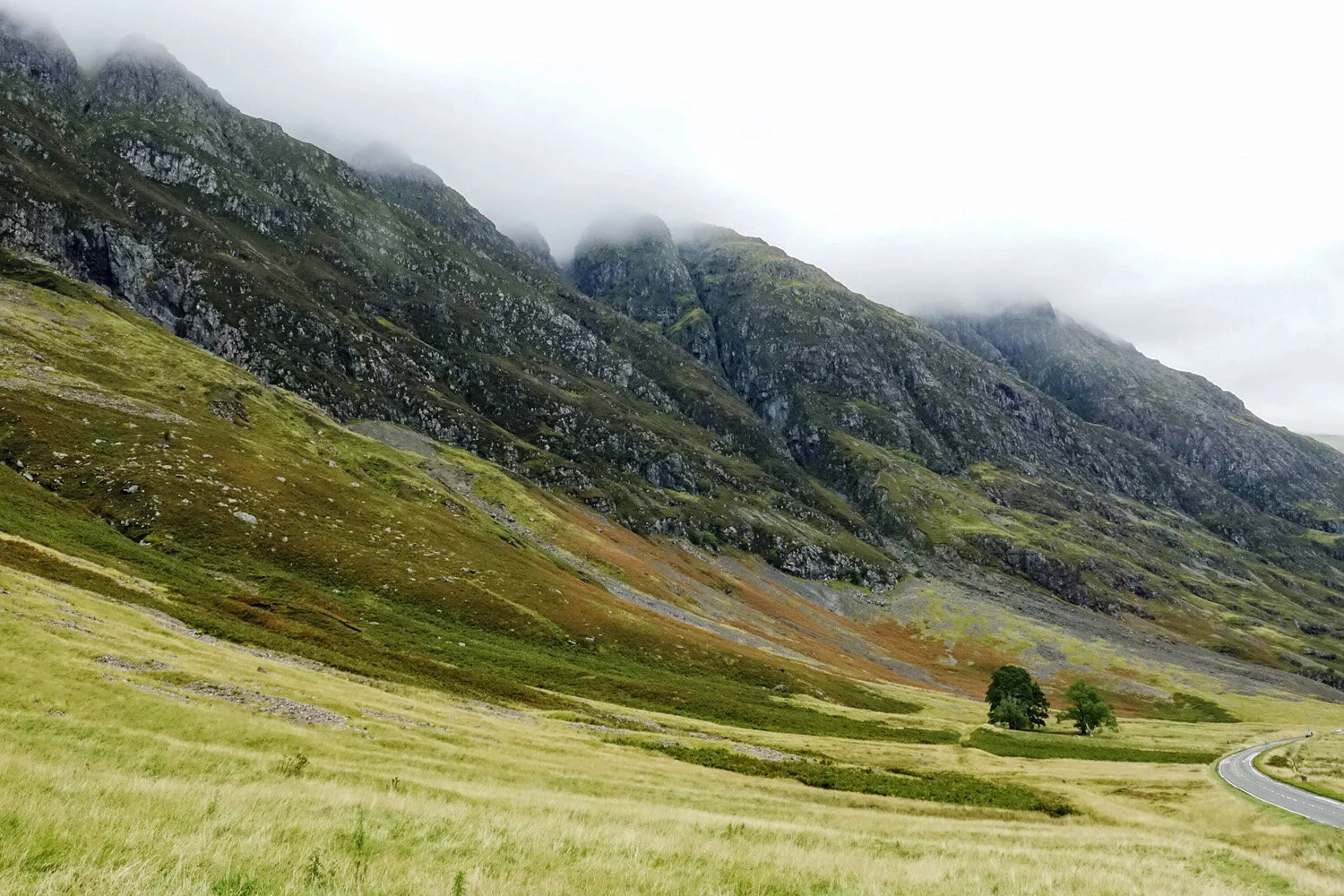
Road along base of valley

Scottish Highlands Landscape Experience

January 7, 2020

A quick look at a topographic map of Scotland reveals the strong and clear pattern of mountains, valleys, lochs and coastline that form the landscape framework of the country.

I was fortunate to travel with my family in the Scottish Highlands in September last year for the first time and experience its spectacular landscapes. We were lucky to have good weather which allowed the full scale and splendour of the Highlands to be revealed but perhaps gave us a somewhat skewed impression of the climate.
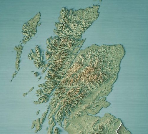
Topographic model of Scottish Highlands

Topographic model of Scottish Highlands

Rocky outcrops expose the skeleton of the mountain landscape with a vegetative skin of heath and grasses covering most of it. Swathes of flowering heather together with patches of moss and pasture form a visually diverse but integrated landscape.

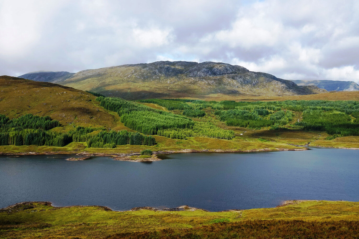
In locations where trees have been established the geometric layout of the plantations strongly contrasts with the informal patchwork of heath, grass and rock. It is easy to understand why there has been a long running debate about the visual and ecological impact of establishing and harvesting tree plantations in the Scottish Highlands.

The debate that followed the Second World War led to the appointment of the renowned landscape architect Sylvia Crowe by the Forestry Commission in 1964. Although the initial focus was on financial objectives, the importance of landscape aesthetics was re-established through a combination of environmental policies that were implemented by the late 1980s.

The spectacular landscapes of the Scottish Highlands provide a major source of tourist revenue. Visitors are attracted by what they perceive to be Scotland’s unspoiled landscape. Consequently the promotion, regeneration and restoration of native woodlands are seen as economic necessities if the landscape character that most visitors to Scotland expect to see is to continue to be retained. Timber-producing single-species timber plantations are being partly replaced by the preferred forest type of diverse species that feature Scots pine and oak woodlands.

A key aspect of travelling in the Scottish Highlands is the clear relationship between the road alignment and the topography with roads generally running either along the water edge of lochs or along the base of valleys. The experience of crossing the divide between valleys provides spectacular panoramic views from the tops of the divides.

Travelling within the valleys of the Highlands provides a strong sense of enclosure with mountain slopes rising sharply from the valley floor. In those valleys containing lochs the water surface provides a constantly changing reflection of the sky and adjoining mountain slopes. Fast moving clouds and changing light and shadow across the landscape add to the dynamic experience of travelling through the Highlands.

One somewhat surprising aspect of the Highlands landscape was the abundance of water with the constant flow of streams and waterfalls fed by seepage from the peat and shallow soils on the mountain slopes even when it is not actually raining.

The rugged natural character of the Highlands landscapes enhances the appreciation of various elements of constructed infrastructure such as the locks along the Caledonia Canal at Fort Augustus that raises vessels 12 metres from Loch Ness to Loch Oich. The sequence of opening and closing the gates to flood and empty the five locks to allow boats to traverse the level change provided a memorable experience and an appreciation of the engineering skill and determination of the builders in 1816-20.

A memorable aspect of the Highlands is the cultural heritage that is expressed by historic structures that include forts, castles and mansions, both occupied and abandoned that punctuated the landscape. Each structure has a distinctive relationship to the landscape in which it sits. In many situations forests and planted trees form key elements of the landscape setting.

The absence of trees in most situations allows for long distance panoramic views in which the topography, light and shadow are in a constant and dramatic state of flux. My strongest memory of travelling in the Highlands is the sense of being somewhat overwhelmed by the scale of the landscape while being inspired by its beauty and drama.


View fullsize Houses along at base of mountain near Dornie
View fullsize Mansion at base of mountain
View fullsize Dawn over Caledonian Canal near Fort Augustus
View fullsize Waterfall at base of mountain
View fullsize Lake with forest plantation beyond
View fullsize Ben Nevis with forest plantation in mid-distance
View fullsize View from ferry between Armadale & Malaig
View fullsize Glenfinnan Viaduct & forest plantation
View fullsize Glenfinnan Monument erected in 1815 where Bonnie Prince Charlie raised his standard at the beginning of the Jacobite Rising in 1745
View fullsize Eilean Donan Castle at Dornie
View fullsize View from ferry between Armadale & Malaig
View fullsize Heath covered slopes & forest plantation
View fullsize Forest plantation adjoining lake
View fullsize Rainbow over valley with forest plantation in foreground
View fullsize Brook flowing through highland meadow
View fullsize Locks along the Caledonia Canal at Fort Augustus
View fullsize Loch Ness at twilight
View fullsize Rocky coastline near Duntulm Castle on Isle of Skye
View fullsize Duntulm Castel ruins on Isle of Skye
View fullsize Duntulm Castel Ruin with grazing sheep
View fullsize Coastal meadow at Duntulm Castle
View fullsize Light along coast of Isle of Skye
← Salesforce Transit Centre Rooftop Park, San FranciscoOld Rangoon →

Subscribe

Sign up to receive updates.

We respect your privacy.

Thanks! We'll be in touch

FEATURED BLOG POSTS

Featured
7. View location 2 in 2020 - View southeast  showing Koala habitat planting adjoining new highway.jpg
Koala Habitat Establishment, Pacific Highway Upgrade, Wardell, NSW

A recent visit to Ballina on the north coast of NSW provided an opportunity to visit a 130 hectare area of new Koala habitat west of Wardell that Corkery Consulting was involved in. The project formed part of the Pacific Highway upgrade and provided a rare opportunity to contribute to the creation new habitat to support one of Australia’s iconic wildlife species, which is under increasing threat of extinction. It was particularly gratifying to see stands healthy trees beginning to provide new habitat for local Koala communities and a corridor connection between significant areas known habitat.

Read more →
Cover image.jpg
Gulgong Holtermann Museum, Photography Exhibition

On a recent visit to Mudgee we decided to visit Gulgong on our way back to Sydney. While I was aware that images of the town are featured on the original $10 bill issued in 1966, it was a very pleasant surprise to learn that the images the $10 bill were from the Holtermann Collection and that the recently constructed museum presents that portion of the Collection that comprises 350 historic images of Gulgong during the gold rush in the second half of the 19th century.

Read more →
2-Odgers _ McClelland Store on main street of Nundle.jpg
Nundle

Turn-off signs to Nundle appear at a number locations along the New England Highway south of Tamworth. While we had noticed the signs on numerous trips between Sydney and Uralla it was not until early this year that we visited Nundle. Located east of the highway and about 56 kilometers south of Tamworth the village of Nundle requires a detour to visit, so we decided to spend a night there to allow enough time to explore the village and surrounding landscape. The visit turned out to be a very enjoyable one that gave a delightful sense of discovery.

Read more →
03. Edge of park & metal screen (for cover).jpg
Salesforce Transit Centre Rooftop Park, San Francisco

On a recent trip to San Francisco I took the opportunity to visit a new rooftop urban park located on top of the Salesforce Transit Centre located in the central business district that incorporates a bus interchange and provision for a future high-speed rail station below.

Designed by PWP Landscape Architecture the 2.2 hectares rooftop park is about 440 m long and 50 m wide. Inclusion of the rooftop park was a key element in the winning architectural design by Pelli Clarke Pelli Architects (PCPA).

Read more →
Road along base of valley
Scottish Highlands Landscape Experience

A quick look at a topographic map of Scotland reveals the strong and clear pattern of mountains, valleys, lochs and coastline that form the landscape framework of the country. I was fortunate to travel with my family in the Scottish Highlands in September last year for the first time and experience its spectacular landscapes.

Read more →
Old Rangoon
Old Rangoon

Until fairly recently access to Myanmar, known as Burma until 1988, presented a difficult challenge after decades of military imposed isolation. However, the country is gradually opening up to foreigners and I was fortunate to recently visit the capital Yangon for a project in the central region of the country. Formerly known as Rangoon, the city is one of mystery and intrigue partly created by the period of isolation but also the cultural layers that have been created over centuries. One of those layers involved Hokkien, Cantonese and Hakka Chinese traders who settled in Rangoon during the 1800’s. However the dominant layer was created by British Colonial rule, which fundamentally changed the physical and social fabric of the city.

Read more →
Myanmar Pagoda Construction

Pagodas are visually prominent elements throughout the landscape of Myanmar, earning the country the title "Land of Pagodas”. While pagodas feature prominently in several cities, including Yangon, Mandalay and Bagan they also occur commonly in rural areas.

On a recent visit to central Myanmar I was very fortunate to be able to visit a new pagoda under construction and walk though the internal spaces.

Read more →
Waverton Coal Loader and Henry Lawson

Located on the western side of Waverton Peninsula, the Coal Loader presents a curious relic of heritage infrastructure with an overlay of contemporary urban landscape treatment. Set in the context of Sydney Harbour and the bushland environment of Balls Head, the site was originally a place of physical and spiritual sustenance for Aboriginal Australians.

Read more →
Cornell Tech Campus, Roosevelt Island, New York City

One of the great experiences of the New York Subway system is that you can enter it from the context of one urban area of the City and then pop out in another urban space that has a totally different character.  

On a recent visit to New York I left the rather undistinguished urban setting of 14th Street and 6th Avenue, descending to the subway and soon after popping out at street level on Roosevelt Island in the middle of the East River. Walking out on to the street I was confronted by the dramatic juxtaposition of the East River in the foreground and Manhattan skyline beyond, with the massive steel structure of the Queensboro Bridge looming above.

Read more →
pop jets.jpg
Domino Park, Williamsburg, Brooklyn, NYC

Located on the edge of Williamsburg in Brooklyn, Domino Park is the outcome of a large scale urban redevelopment of the former Domino Sugar Factory site. The 2.4 ha Park forms another new open space on a former industrial site that provides public access to the East River waterfront alongside the Williamsburg Bridge opposite Manhattan.

Walking towards the waterfront park through the dense urban fabric of Brooklyn the spatial experience is dramatised by views that open up between buildings and extend across the East River with the massive steel structure of the Williamsburg Bridge above.

Read more →

FEATURED NEWS POSTS

Featured
Linda & Noel at the 'Meet the Professor' event.jpg
Linda Appointed as Professor Emeritus at University of NSW
Read more →
LCorkery_AILA-from architecture and design.JPG
'Learning from the landscape: Linda Corkery' article published in Foreground
Read more →
02-W2B_PacificHighwayUpgrade - image CorkeryConsulting+StudioColinPolwarth.jpg
Woolgoolga to Ballina Pacific Highway Upgrade wins AILA NSW 2019 Landscape Architecture Award for Infrastructure
Read more →
1-shade and poles.jpg
Leichhardt Park Child Care Centre Opens
Read more →
Linda appointed Professor at UNSW
Read more →
LC Photo Nov13_(1500px150dpi).jpg
Linda presents ‘Green City, Resilient City’ in Hong Kong
Read more →
9.jpg
Elizabeth McCrea Park Playground grand opening
Read more →
Urban Ecology Renewal Investigation
Read more →
Designing Cities with Children and Young People: Beyond Playgrounds and Skate Parks
Read more →
GOOD DESIGN® 2017 selection for Rhodes Peninsula Open Space Master Plan in Architectural Design Category.
Read more →

© 2021 Corkery Consulting