• Profile
    • Approach
    • People
    • Publications
  • Projects
  • Competitions
  • News
  • Blog
  • CONTACT
Menu

Corkery Consulting

Landscape Architecture + Urban Design | AUSTRALIA
  • STUDIO
    • Profile
    • Approach
    • People
    • Publications
  • Projects
  • Competitions
  • News
  • Blog
  • CONTACT

Brooklyn Bridge Park

April 27, 2017

Despite New York’s relentless commercial development, the city administrators still manage to create new public open spaces to meet the community needs. The Hudson River and East River waterfronts have formed the primary focus for much of this new public open space. A recent visit to New York in April provided an opportunity to see how development of a number of new waterfront open spaces progressed since my previous visit a few years ago.

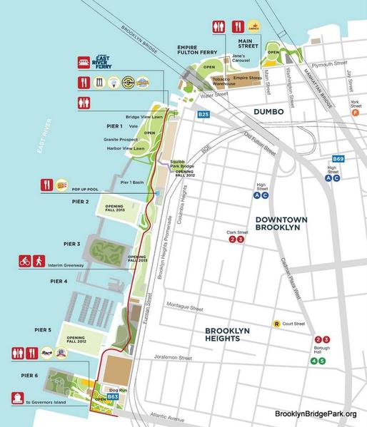
Walking west along Clark Street from the Metro Station, the East River can be glimpsed between the heritage buildings of Brooklyn Heights. But it is not until you finally reach the Brooklyn Heights Promenade that the spectacular view of the Manhattan skyline dramatically opens up. Located above two stacked levels of motorway the wide pedestrian Promenade extends for some 540m. From the front edge of the Promenade you become aware of the whole Brooklyn Bridge Park located below. This 34 ha linear park located along the East River foreshore incorporates post-industrial land and disused piers associated with former port facilities. Extending 2.1 km from the Manhattan Bridge past the Brooklyn Bridge to Atlantic Avenue the Park incorporates six piers together with the historic Fulton Ferry Landing and the pre-existing Empire–Fulton Ferry and Main Street Parks as shown on the Park Map. Visitors are provided with a diverse range of engaging spaces that incorporate active and passive recreation and sports facilities.

As with many public open spaces in New York the creation of Brooklyn Bridge Park started with a community action group playing a key role in promoting the concept. In response to intense community pressure the City and State of New York signed an agreement in 2002 to develop the Park. The Brooklyn Bridge Park Development Corporation was created and in 2004 the Corporation engaged landscape architecture firm of Michael Van Valkenburgh Associates (MVA) to masterplan and design the whole Brooklyn Bridge Park. Construction started in 2008 and development has proceeded in stages generally in the following sequence.

The first stage of the Park development was Pier 1 which was opened in March 2010. Extensive seating along a wide waterfront promenade allow visitors to watch boating activity on the River with a backdrop of the Manhattan skyline. Sloping lawn areas with striking views across the River are extensively used for sun-bathing, picnicking and relaxing. In contract a series of adjoining paths are visually enclosed by tree and shrub planting.

Pier 6 was opened later in 2010 to provide a diverse combination of amenities, including sand volleyball courts, concessionaires, a dog run, and plantings. The pier also contains four themed playgrounds that include Swing Valley, Slide Mountain, Sandbox Village, and a Water Lab. The Governor's Island Ferry departs from this pier to provide access to the Island during warmer months.

Pier 5 was opened in December 2012 and contains three athletic fields, two playgrounds and a picnic area, with development of 2 ha site costing US $26 million.

Pier 3 was opened in November 2013 and includes the Greenway Terrace, which provides expansive lawns, a granite terrace and a steep-sided earth mound to attenuate noise from the adjoining motorway. The Pier 3 Greenway Terrace completes the continuous waterfront promenade that runs from Pier 1 to Pier 6.

A new 2 hectare park designed by MVA is under construction on the concrete deck of Pier 3 adjoining the Greenway Terrace and is due for completion in 2018.

Pier 2 opened in May 2014 and provides active recreation facilities on a former warehouse dock.

Pier 4 incorporates an area of sandy beach and is planted with native species to assist its ongoing evolution as a protected habitat preserve. It was built from the remnants of a railroad float transfer bridge that settled on the river bed.

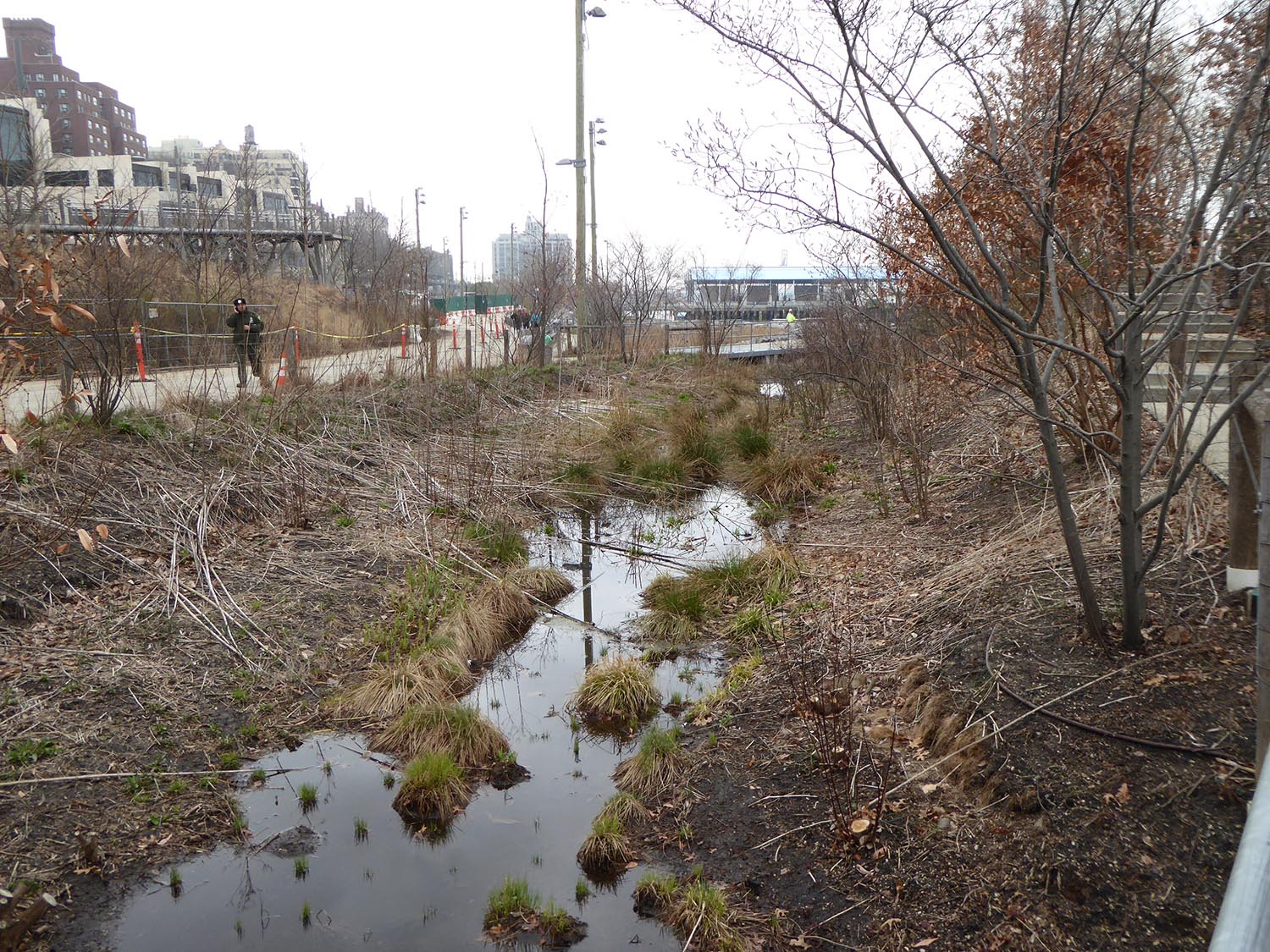
A distinctive feature of the Brooklyn Bridge Park is the extensive water quality management system that is integrated into the landscape design. A system of vegetated swales and water quality ponds improve the quality of stormwater run-off before it is discharged in to the East River. 

Design of the foreshore treatment has created new inter-tidal marine habitats through the use of stone revetments. Bio-diversity has also been enhanced by extensive planting of trees, shrubs and groundcovers combined with construction of wetlands.    

A new hotel has been constructed along the eastern of the Park adjoining Pier 1 that incorporates roof gardens that are visible from the Brooklyn Heights Promenade above. Pedestrian access between Park and the upper walkway of the Promenade is provided by a new bridge.

The Brooklyn Bridge Park Corporation is responsible for the planning, construction, maintenance, and operation of the Park. The Corporation is a not-for-profit organisation with a mission to "create and maintain a world class park that is a recreational, environmental and cultural destination enjoyed by residents of, and visitors to, New York City". So far it has fulfilled that mission exceptionally well.
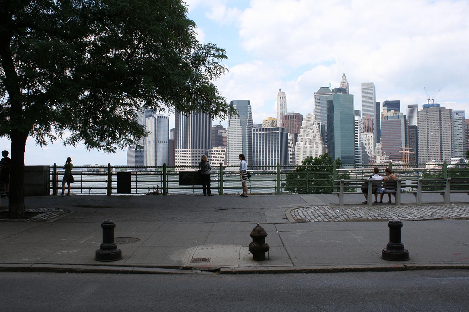
View fullsize Brooklyn Heights Promenade view to Manhatton
Brooklyn Heights Promenade view to Manhatton
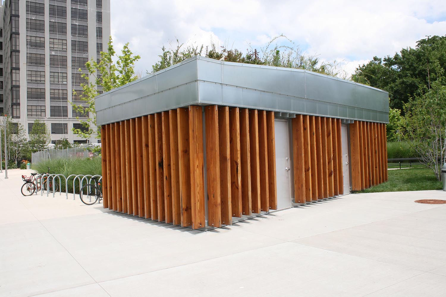
View fullsize Amenities building
Amenities building
View fullsize Brooklyn Bridge Park map
Brooklyn Bridge Park map
View fullsize Earth mound to attenuate noise from motorway
Earth mound to attenuate noise from motorway
View fullsize Greenway Terrace 2
Greenway Terrace 2
View fullsize Intertidal marine habitat adjoining Pier 3
Intertidal marine habitat adjoining Pier 3
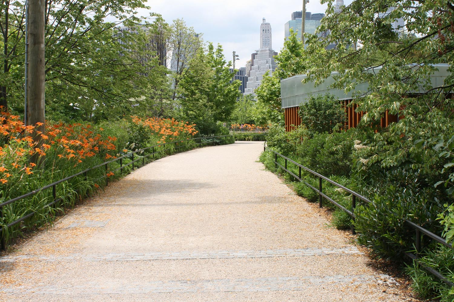
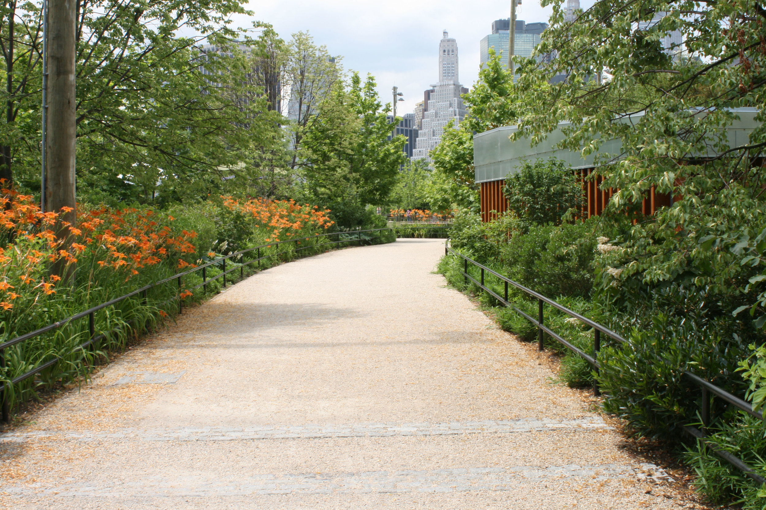
View fullsize Ornamental planting adjoining path
Ornamental planting adjoining path
View fullsize Pedestrain & cycle path near Pier 6
Pedestrain & cycle path near Pier 6
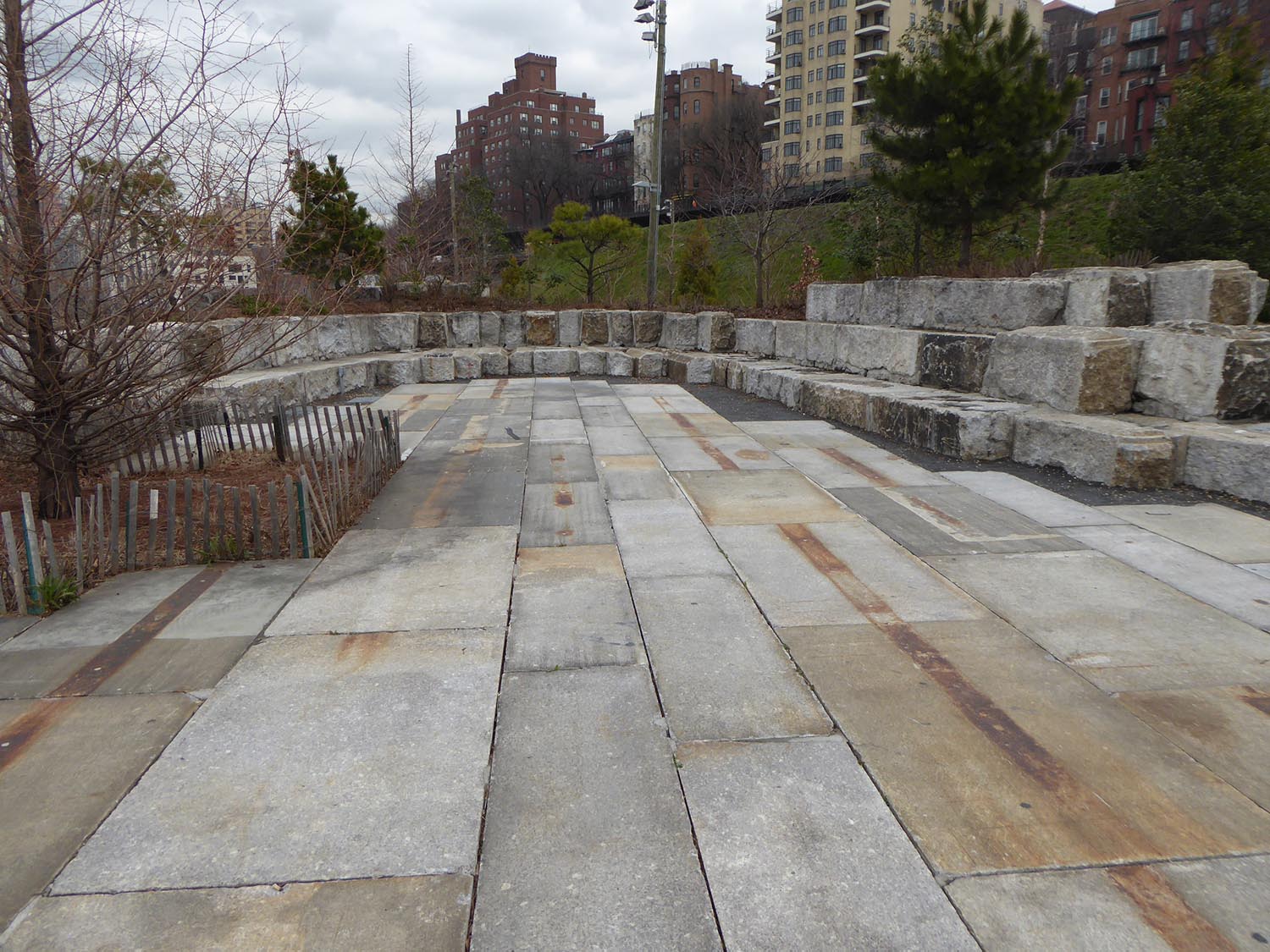
View fullsize Seating steps
Seating steps
View fullsize Sloping lawn on Pier 1
Sloping lawn on Pier 1
View fullsize Sports facilities on Pier 2
Sports facilities on Pier 2
View fullsize Water quality swale adjoining Pier 1 - summer
Water quality swale adjoining Pier 1 - summer
View fullsize Water quality swale adjoining Pier 1 in winter 2
Water quality swale adjoining Pier 1 in winter 2
View fullsize Water quality swale adjoining Pier 1 summer 2
Water quality swale adjoining Pier 1 summer 2
View fullsize Water quality swale adjoining Pier 1 in winter 1
Water quality swale adjoining Pier 1 in winter 1
View fullsize Waterfront walkway on Pier 1
Waterfront walkway on Pier 1
Tags Waterfront, Public Open Space, International
← Olympic Sculpture Park, SeattleBarangaroo Headland Park, Sydney →

Subscribe

Sign up to receive updates.

We respect your privacy.

Thanks! We'll be in touch

FEATURED BLOG POSTS

Featured
7. View location 2 in 2020 - View southeast  showing Koala habitat planting adjoining new highway.jpg
Koala Habitat Establishment, Pacific Highway Upgrade, Wardell, NSW

A recent visit to Ballina on the north coast of NSW provided an opportunity to visit a 130 hectare area of new Koala habitat west of Wardell that Corkery Consulting was involved in. The project formed part of the Pacific Highway upgrade and provided a rare opportunity to contribute to the creation new habitat to support one of Australia’s iconic wildlife species, which is under increasing threat of extinction. It was particularly gratifying to see stands healthy trees beginning to provide new habitat for local Koala communities and a corridor connection between significant areas known habitat.

Read more →
Cover image.jpg
Gulgong Holtermann Museum, Photography Exhibition

On a recent visit to Mudgee we decided to visit Gulgong on our way back to Sydney. While I was aware that images of the town are featured on the original $10 bill issued in 1966, it was a very pleasant surprise to learn that the images the $10 bill were from the Holtermann Collection and that the recently constructed museum presents that portion of the Collection that comprises 350 historic images of Gulgong during the gold rush in the second half of the 19th century.

Read more →
2-Odgers _ McClelland Store on main street of Nundle.jpg
Nundle

Turn-off signs to Nundle appear at a number locations along the New England Highway south of Tamworth. While we had noticed the signs on numerous trips between Sydney and Uralla it was not until early this year that we visited Nundle. Located east of the highway and about 56 kilometers south of Tamworth the village of Nundle requires a detour to visit, so we decided to spend a night there to allow enough time to explore the village and surrounding landscape. The visit turned out to be a very enjoyable one that gave a delightful sense of discovery.

Read more →
03. Edge of park & metal screen (for cover).jpg
Salesforce Transit Centre Rooftop Park, San Francisco

On a recent trip to San Francisco I took the opportunity to visit a new rooftop urban park located on top of the Salesforce Transit Centre located in the central business district that incorporates a bus interchange and provision for a future high-speed rail station below.

Designed by PWP Landscape Architecture the 2.2 hectares rooftop park is about 440 m long and 50 m wide. Inclusion of the rooftop park was a key element in the winning architectural design by Pelli Clarke Pelli Architects (PCPA).

Read more →
Road along base of valley
Scottish Highlands Landscape Experience

A quick look at a topographic map of Scotland reveals the strong and clear pattern of mountains, valleys, lochs and coastline that form the landscape framework of the country. I was fortunate to travel with my family in the Scottish Highlands in September last year for the first time and experience its spectacular landscapes.

Read more →
Old Rangoon
Old Rangoon

Until fairly recently access to Myanmar, known as Burma until 1988, presented a difficult challenge after decades of military imposed isolation. However, the country is gradually opening up to foreigners and I was fortunate to recently visit the capital Yangon for a project in the central region of the country. Formerly known as Rangoon, the city is one of mystery and intrigue partly created by the period of isolation but also the cultural layers that have been created over centuries. One of those layers involved Hokkien, Cantonese and Hakka Chinese traders who settled in Rangoon during the 1800’s. However the dominant layer was created by British Colonial rule, which fundamentally changed the physical and social fabric of the city.

Read more →
Myanmar Pagoda Construction

Pagodas are visually prominent elements throughout the landscape of Myanmar, earning the country the title "Land of Pagodas”. While pagodas feature prominently in several cities, including Yangon, Mandalay and Bagan they also occur commonly in rural areas.

On a recent visit to central Myanmar I was very fortunate to be able to visit a new pagoda under construction and walk though the internal spaces.

Read more →
Waverton Coal Loader and Henry Lawson

Located on the western side of Waverton Peninsula, the Coal Loader presents a curious relic of heritage infrastructure with an overlay of contemporary urban landscape treatment. Set in the context of Sydney Harbour and the bushland environment of Balls Head, the site was originally a place of physical and spiritual sustenance for Aboriginal Australians.

Read more →
Cornell Tech Campus, Roosevelt Island, New York City

One of the great experiences of the New York Subway system is that you can enter it from the context of one urban area of the City and then pop out in another urban space that has a totally different character.  

On a recent visit to New York I left the rather undistinguished urban setting of 14th Street and 6th Avenue, descending to the subway and soon after popping out at street level on Roosevelt Island in the middle of the East River. Walking out on to the street I was confronted by the dramatic juxtaposition of the East River in the foreground and Manhattan skyline beyond, with the massive steel structure of the Queensboro Bridge looming above.

Read more →
pop jets.jpg
Domino Park, Williamsburg, Brooklyn, NYC

Located on the edge of Williamsburg in Brooklyn, Domino Park is the outcome of a large scale urban redevelopment of the former Domino Sugar Factory site. The 2.4 ha Park forms another new open space on a former industrial site that provides public access to the East River waterfront alongside the Williamsburg Bridge opposite Manhattan.

Walking towards the waterfront park through the dense urban fabric of Brooklyn the spatial experience is dramatised by views that open up between buildings and extend across the East River with the massive steel structure of the Williamsburg Bridge above.

Read more →

FEATURED NEWS POSTS

Featured
Linda & Noel at the 'Meet the Professor' event.jpg
Linda Appointed as Professor Emeritus at University of NSW
Read more →
LCorkery_AILA-from architecture and design.JPG
'Learning from the landscape: Linda Corkery' article published in Foreground
Read more →
02-W2B_PacificHighwayUpgrade - image CorkeryConsulting+StudioColinPolwarth.jpg
Woolgoolga to Ballina Pacific Highway Upgrade wins AILA NSW 2019 Landscape Architecture Award for Infrastructure
Read more →
1-shade and poles.jpg
Leichhardt Park Child Care Centre Opens
Read more →
Linda appointed Professor at UNSW
Read more →
LC Photo Nov13_(1500px150dpi).jpg
Linda presents ‘Green City, Resilient City’ in Hong Kong
Read more →
9.jpg
Elizabeth McCrea Park Playground grand opening
Read more →
Urban Ecology Renewal Investigation
Read more →
Designing Cities with Children and Young People: Beyond Playgrounds and Skate Parks
Read more →
GOOD DESIGN® 2017 selection for Rhodes Peninsula Open Space Master Plan in Architectural Design Category.
Read more →

© 2021 Corkery Consulting